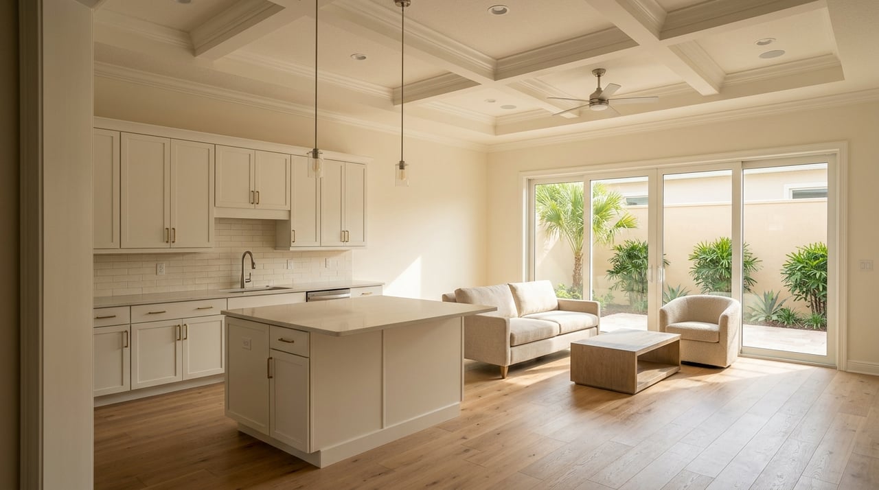
If you are searching for an Englewood home with Gulf access, one word on a listing can change your whole plan: access. In this part of Sarasota County, that usually means access through Lemon Bay, not instant deep water at your dock. If you want the right fit for your boat, your budget, and your long-term ownership goals, it helps to understand how the local waterway really works. Let’s dive in.
Understand Englewood water access
In Englewood, the Gulf-access conversation is really about Lemon Bay. This estuary stretches about 13 miles and is separated from the Gulf by Manasota Key and Little Gasparilla Island.
Lemon Bay is also a protected waterbody. Florida classifies it as an aquatic preserve and an Outstanding Florida Waterbody, which matters because boating, shoreline work, and long-term maintenance all happen in a more sensitive coastal setting.
Another key point is depth. In many areas, Lemon Bay is shallow and water depth rarely exceeds 6 feet, with limited depth outside marked channels. Most of the waterbody is also slow speed outside the Intracoastal Waterway, so your route to open water may be more gradual than a listing description suggests.
If your plan includes running through Stump Pass, use extra caution. NOAA notes that the south-end Gulf outlet changes frequently and should not be attempted without local knowledge.
Know what “Gulf access” can mean
Not all waterfront homes in Englewood offer the same boating experience. Gulf access is a spectrum, and your day-to-day use can vary based on canal depth, bridges, turning space, and how quickly you can reach the Intracoastal Waterway.
Canal homes
Canal homes are often the most sheltered option. They can be a strong fit for smaller powerboats, skiffs, and buyers who want a private dock close to home.
The main questions are practical ones. Is the canal deep enough for your boat’s actual draft, and will future dock or lift work require permits? Those details can shape both your upfront buying decision and your long-term costs.
Sailboat-access and low-bridge routes
Terms like sailboat access can be helpful, but they are not a substitute for verification. You should confirm mast height, actual bridge clearances, and route depth before relying on marketing language.
In the broader Lemon Bay and Intracoastal system, NOAA lists 26-foot vertical clearances at the SR 776 and Manasota Beach bascule bridges, along with a 9-foot fixed clearance over Rock, also called Ainger, Creek. If your boat sits close to those limits, a small mistake can become a major problem.
Bayfront homes
Bayfront homes can offer a shorter path to open water and more room to maneuver. That can be appealing if you want direct waterfront living and a broader water view.
Still, bayfront does not remove the need for due diligence. Lemon Bay remains a shallow estuary, with limited depths outside marked channels and widespread slow-speed areas outside the Intracoastal Waterway.
Barrier-island and beach-area homes
If you are looking on Manasota Key or another beach-adjacent parcel, the rules can become more layered. Coastal construction review may apply, and some work near the shoreline may require county, state, or federal approvals.
That does not make these properties less attractive. It simply means you should understand the design and permitting path before you buy, especially if you expect to add or modify waterfront improvements later.
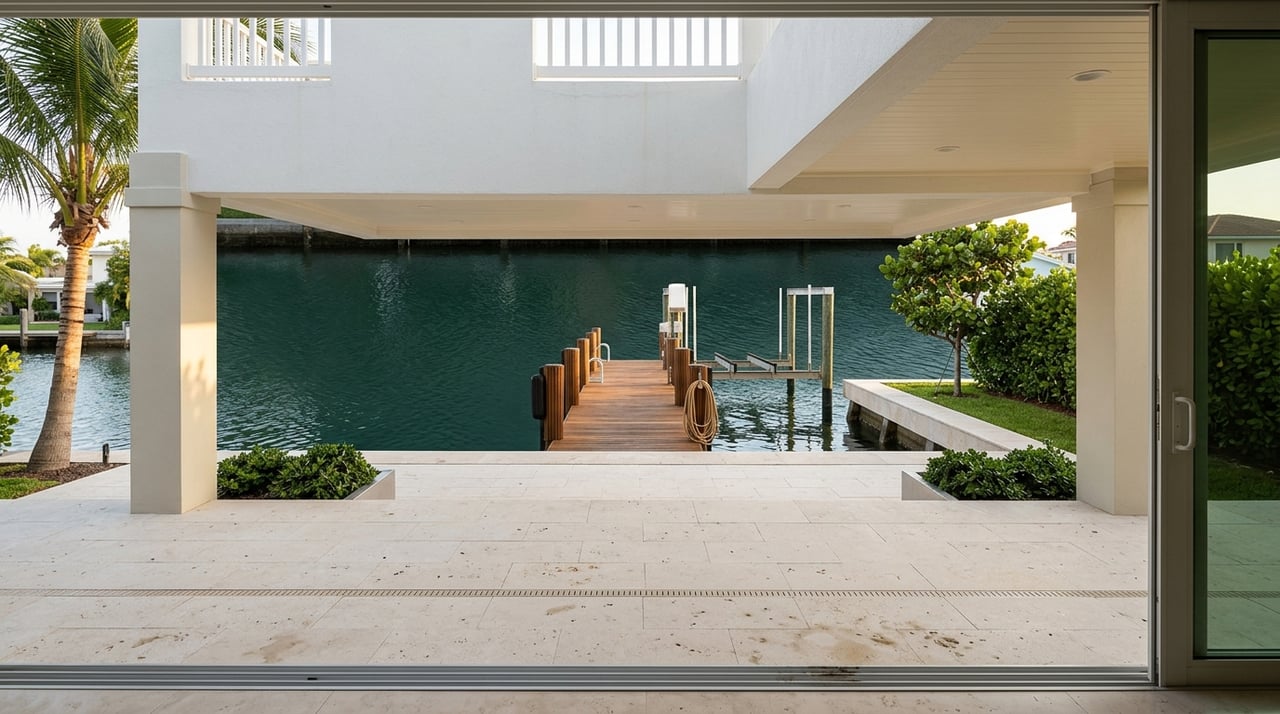
Verify the route, not just the dock
One of the biggest buyer mistakes is focusing only on the property itself. A beautiful dock does not help much if the route from that dock to open water does not work for your boat.
Use current NOAA chart information instead of relying on listing copy alone. NOAA explains that chart numbers are depth soundings, and its Custom Chart data are refreshed from the latest official ENC data every weekday.
In practice, you will want to evaluate:
- Your boat’s actual draft
- Tide conditions
- Channel location
- Bridge clearances along the route
- Turning room in canals or basins
- Conditions near the pass if you plan Gulf runs
This matters because not every so-called deep-water route performs the same way. NOAA navigation notes include historical reported depths of 6 feet in some small-craft approach channels at The Cutoff and 4.0 feet to the Englewood marina, which is a good reminder to verify the full path, not just the headline description.
Check permits before you make an offer
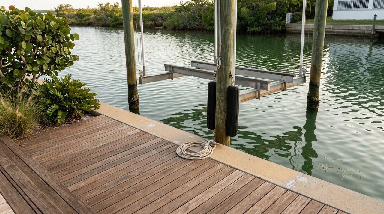
Waterfront improvements are not just features. They are also part of the property’s compliance history.
Ask for permit history on every dock, lift, bulkhead, revetment, or dredged cut. Sarasota County’s Environmental Protection Division reviews permits for items such as docks, boat lifts, bulkheads, revetments, and maintenance dredging.
Repairs and replacements to existing permitted structures may fall under general permits in some cases. New docks, modifications, and maintenance dredges usually require Minor Work Permits, and some single-family dock projects may follow self-certification or exemption workflows through the state. Even then, the owner remains responsible for obtaining all required approvals.
This is important for buyers because an unverified improvement can create delays, extra cost, or limits on future changes. If a dock, lift, or shoreline edge is central to your purchase decision, permit review should be part of your due diligence early in the process.
Separate boating access from flood risk
A home can offer workable boating access and still carry meaningful flood exposure. These are related waterfront issues, but they are not the same thing.
Sarasota County says new FEMA flood maps took effect on March 27, 2024. Special Flood Hazard Area zones such as A, AE, AH, and VE can trigger elevation compliance and flood insurance requirements.
If a home is in the Special Flood Hazard Area and you use a federally backed mortgage, flood insurance is required for residential and commercial buildings. Sarasota County also notes that most homeowner policies do not cover flood, and flood insurance typically has a 30-day waiting period.
For buyers, this means you should review the flood zone as carefully as you review the dock. A property that looks perfect on the water may carry ownership costs and insurance requirements that change the full picture.
Plan for long-term waterfront maintenance
Owning waterfront property in Englewood is about more than a great sunset or weekend boating. It also means staying realistic about shoreline conditions, stormwater issues, and the upkeep that can come with living on or near the bay.
Sarasota County’s Lemon Bay Watershed Management Plan identifies flooding and water-quality hotspots in the watershed. The county has also highlighted restoration work tied to creeks that affect Lemon Bay water quality, including efforts to reduce erosion and improve habitat.
For you as a buyer, that makes long-term maintenance part of the decision. Canal sedimentation, bank stabilization, and stormwater management are not abstract concerns here. They are part of the ownership reality in a coastal, shallow-water system.
Respect local boating and habitat rules
Lemon Bay is a boating destination, but it is also a protected habitat. That means local ownership comes with responsibilities on the water.
Sarasota County is a priority protection site for manatees, and Lemon Bay includes manatee protection zones from the Sarasota and Charlotte county line to the Gasparilla Causeway. Where local and state manatee rules overlap, the most restrictive regulation applies once signs are posted.
The county also notes that its Manatee Protection Plan review applies to developments with five or more motorized slips, though not to single-family docks. On the water, state guidance also warns boaters to avoid prop scarring and stay mindful of marked channels in this shallow habitat.
For many buyers, this is not a drawback. It is part of what makes the area special. Still, it is smart to understand the operating environment before you buy.
Keep a backup launch option in mind
Even if you plan to keep a boat at home, a trailer option can still be helpful. That can matter if you want flexibility, need a backup while dock work is being done, or prefer different launch points for different kinds of boating days.
The preserve’s public access list includes county ramps such as Indian Mound Park, Ainger Creek Park, and Placida Park. If your boating lifestyle includes a trailer boat, those access points may add useful convenience.
What the right Englewood waterfront looks like
The best Gulf-access home in Englewood is not always the one with the boldest listing language. It is the one that matches your boat size, draft, bridge needs, flood-zone comfort, and maintenance appetite.
For some buyers, that means a protected canal home with a lift for a smaller boat. For others, it means a bayfront property with a shorter route out, paired with a clear understanding of shallow-water navigation and flood planning.
A smart purchase starts with clear questions and local context. If you evaluate access as a spectrum instead of a simple yes-or-no label, you will make a much stronger decision.
If you want help sorting through Englewood waterfront options with a practical eye toward boating fit, ownership costs, and long-term value, connect with The Pergerson Group.
FAQs
What does Gulf access mean for homes in Englewood?
- In Englewood, Gulf access usually means access through Lemon Bay and nearby channels, not automatic deep water or unrestricted navigation from every dock.
What should buyers verify about an Englewood dock route?
- You should confirm current route depth, tide conditions, bridge clearances, turning space, and how your boat’s actual draft fits the full path to open water.
What bridge clearances matter for Englewood boaters?
- NOAA lists 26-foot vertical clearances at the SR 776 and Manasota Beach bascule bridges and a 9-foot fixed clearance over Rock, or Ainger, Creek.
What permits should buyers check on an Englewood waterfront home?
- Buyers should ask for permit history on docks, lifts, bulkheads, revetments, and any dredged areas because future repairs or changes may require county or state approval.
How does flood risk affect Englewood Gulf-access homes?
- Flood risk is separate from boating access, and homes in Special Flood Hazard Area zones may have elevation rules and flood insurance requirements, especially with federally backed mortgages.
Are bayfront homes in Englewood easier for boating?
- Bayfront homes may offer a shorter route and more maneuvering room, but buyers still need to account for shallow water, marked channels, slow-speed areas, and storm-related considerations.
Are there backup boat ramps near Englewood waterfront homes?
- Yes, public access points listed for the preserve include county ramps such as Indian Mound Park, Ainger Creek Park, and Placida Park.